Protecting Wetlands
Our Challenges
As our region grapples with how to address increasingly larger and more intense storms and rising sea levels, protecting our remaining wetland areas at the highest risk of loss due to development and other reasons, becomes ever more important.
The over development of wetlands is exactly what we advocate against, using the clean water act as a tool for change to help guide our legal strategy for wetland protection. The CWA is the principle law governing pollution control and water quality of the Nation’s waterways. Section 404 Permits are required by the U.S. Army Corps of Engineers (USACE) in relation to work that will add or remove discharge of material in “waters of the U.S.” and associated wetlands. BCWK USES section 404 of the Clean-Water Act to protect our wetlands in Houston by making sure people developing these areas have the correct permits and have done the proper analysis for addressing flood protection.
The Value of Our Wetlands
Wetlands are one of our main critical geographical landscapes. They are the areas in between where water and land meet, and serve a vital purpose to our ecological systems in our region. The two main types of wetlands are coastal wetlands and freshwater wetlands, and Houston’s Galveston Bay Watershed comprises both. With approximately 120,000 acres of wetlands in the Galveston Bay Watershed – healthy swamp, fresh marsh, brackish marsh, natural ridges, flood plains, bottom lands, and other wetland habitats play a vital role in our natural protections from climate disasters.
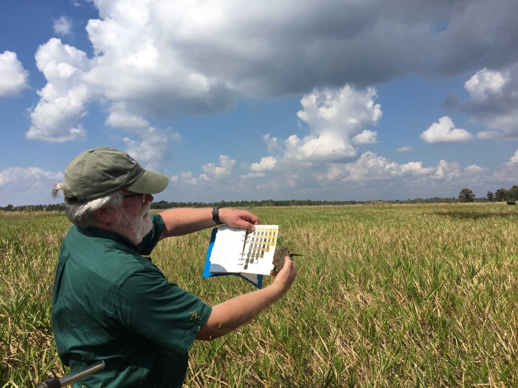
Acre for acre, wetlands protect and is home to more species than any other habitat on earth. Different parts of wetlands all have different functions, making all these different wetland types all equally important. Some of these functions happen to be more physical, such as capturing sediments (soil and debris) during a flood. Other types of wetlands embody chemical functions, such as breaking down pollutants; while other duties are biological, such as providing nursery and spawning grounds for fish and habitat for wildlife (TPWD, 2022). Our robust fish, shrimp, and oyster production harvested from Galveston and other surrounding bays are dependent on healthy coastal wetland nurseries, and our diverse bird species also rely on these areas for feeding and reproduction as well.
Wetlands provide many benefits to people as well. In our Houston region where we are most impacted by flooding from high amounts of rainfall, wetlands act as a natural protector/solution to flooding. Wetlands are created to hold massive amounts of water, without it reaching to other areas surrounding it. In Houston, as we see an influx of people and need for more Housing/development, we are noticing that the most critical wetlands that serve us protection are being developed, worsening flood risk for communities. Wetland Advocacy also calls for the city, county, and other entities to look at Nature Based Solutions such as wetland preservation for protecting BIPOC Communities from patterns of extreme flooding.
Community Resources
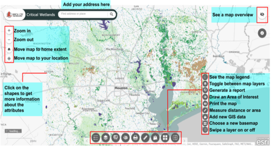
Wetlands Mapping Tool
The wetland mapper has layers dedicated to wetlands mapped by the National Wetlands Inventory (NWI), the boundaries of the five most critical wetland areas, ecological land cover, flood hazard areas delineated by FEMA, county lines, the Lower Galveston Bay Watershed boundary, and the subwatershed boundaries. Users can toggle between these layers or view them simultaneously.
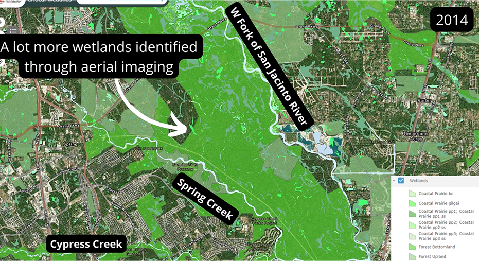
5 Critical Wetlands Story Map
This story map illustrates the diverse ecosystems and wetlands in our region that are in need of protection. It lays the foundation for why conserving wetlands is critical especially in a post-Harvey environment, as they serve as one of nature’s best line of defense against flooding. Utilizing ecologic layers based on aerial imagery to identify large tracts of land in the Lower Galveston Bay watershed, we aim to identify and protect our critical habitats and our Texas coastal prairie wetland areas.