As we commemorate five years of Hurricane Harvey, we remember all that was lost during the storm and aspire to build a resilient region, strengthening our vision for protecting our environment and our people for generations to come.
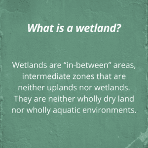
While we recognize the permanence of the trauma that unfolded in the wake of Harvey, we also recognize the need to shift our vision for flood protection towards one that protects our region more holistically by integrating nature-based solutions, strengthening regulation and advocating for what we already have as one of our best defenses from flooding: our coastal prairie wetlands. As Houston continues to expand, we must learn to protect our coastal prairie potholes and our wetland areas and truly recognize them for the value they offer.
Bayou City Waterkeeper’s story map of our 5 Most Critical Wetland areas along with a wetland mapping app aim to create a sense of urgency and hope. We must be urgent in redefining our approach to flood protection and protect what we have left. Studies show as much as 30 percent of prairie wetlands have been lost in Harris county alone.
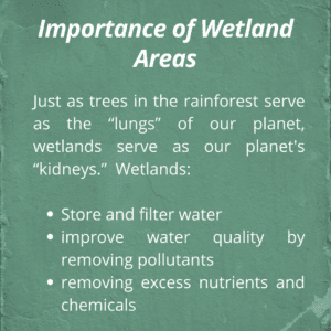
The Lower Galveston Bay Watershed is home to some of the most unique and diverse wetlands in the world. Our wetlands are not only home to millions of migratory birds that benefit from the rich coastal habitat, but they also maintain water quality, protect against erosion, and — especially important for our region — serve as nature’s best defense against flooding. As we strive to protect our depleting wetland areas, we must also be visionary. To increase awareness and strengthen advocacy on the importance of protecting wetlands, Bayou City Waterkeeper works with community members who become our partners on the ground. Our community members are the experts who continue to protect our watershed, their surrounding wetlands and their community from future extreme weather-related flood events and rising climate risk.
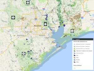
This image above shows the five critical areas we have identified that have some of the most special wetland regions within our watershed. Although other wetland areas exist throughout our watershed, we have selected these five wetland areas because they consist of large tracts that can still be preserved, and are at the greatest risk of loss due to future development.
At least half of the wetlands in our watershed have been lost due to unprecedented and uncontrolled development in our region. We can still save much of what’s left. Scroll through the map to learn more about these areas.
How to use the wetland mapper:
In addition to defining our critical wetland areas, Bayou City Waterkeeper has created a wetland mapper. This wetland mapper is a tool meant for community members to identify wetlands throughout our watershed, understand the delicate relationship between wetlands, our bayous and our waterways and to advocate for the protection of these wetlands from future losses.
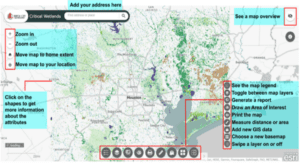
The wetland mapper has layers dedicated to wetlands mapped by the National Wetlands Inventory (NWI), the boundaries of the five most critical wetland areas, ecological land cover, flood hazard areas delineated by FEMA, county lines, the Lower Galveston Bay Watershed boundary, and the subwatershed boundaries. Users can toggle between these layers or view them simultaneously.
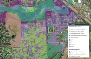
The image above is a screenshot taken from the mapper to demonstrate the interaction between the NWI (National Wetland Inventory) wetland areas, and the US FEMA Flood Hazard layer, along with aerial images of housing in Northwest Houston along Cypress Creek. Notice the residential development over freshwater emergent (light green) and freshwater forested (dark green) wetland areas in relation to Cypress Creek (blue line) and the floodplains (light and dark purple).
What is happening at the federal level to protect wetlands?
 Recently, Waterkeeper Alliance, San Francisco Baykeeper, Bayou City Waterkeeper, and 47 additional Waterkeeper groups from across the country filed an amicus brief with the United States Supreme Court to defend the Clean Water Act (CWA) from efforts to substantially narrow the definition of federally protected waters. Read more here.
“How our wetlands and natural systems are protected directly affects how safe we are from flooding, storm surges, and climate change. We want the Supreme Court justices to understand that the Clean Water Act is this region’s most important law for protecting our natural defenses. It must remain strong and intact.” – Kristen Schlemmer
Bayou City Waterkeeper is a Houston-based organization focusing on water quality and wetlands protection across our region with an emphasis on climate resilience and environmental justice. Use the Wetland Mapper to search for and or identify wetland features throughout our watershed. Share your experience interacting with the app by writing to us at info@bayoucitywaterkeeper.org
